
價格:免費
更新日期:2020-07-06
檔案大小:48.8 MB
目前版本:1.16
版本需求:系統需求:iOS 10.0 或以後版本。相容裝置:iPhone、iPad、iPod touch。
支援語言:英語
IGNrando’ is a French collaborative platform offering curated data and services related to outdoor activities.
RICH DATA OFFER
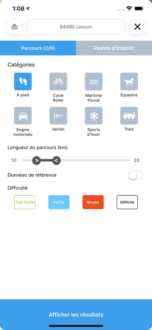
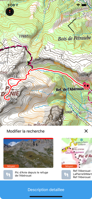
• Tens of thousands of available routes accross Metropolitan and Overseas France
• Choose the activity, difficulty and length to find routes around you or near any other place
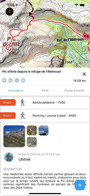
• Download routes or mark them as favorites
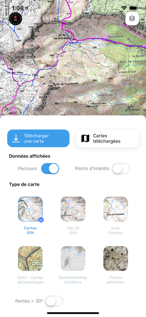
MAPS IN FREE ACCESS (view only)
• Plan IGN: most updated map, suitable for all activities
• Aerial photos (IGN)
• OpenStreetMap Outdoors: collaborative world map with contour lines
GPS GUIDING ALONG ROUTES
• See your progression on the map and on the altitude graph
• Get alerted if you exit the route
• Get notified of upcoming POIs or route info points (available soon)
GPS TRACKING AND DATA CREATION
• Record your own routes using GPS
• Create routes on-device (vertex by vertex)
• Quickly create routes with pedestrian and vehicle routing (automatically follows roads and paths) - available with IGN Maps subscription
• Create POIs (available soon)
• Save locally (Files app) or share your routes
• Send your routes to ignrando.fr for backup or to publish them
OFFLINE USE
• The GPS keeps working even without internet: see your position on the map, use GPS guiding and record routes
• Downloaded routes: descriptions, photos and guiding remain accessible
• Downloaded maps (with subscription)
USEFUL TIP: Enabling Airplane Mode or disabling Mobile Data improves battery life, without affecting the Location Services (GPS)
SUBSCRIPTIONS
IGN Maps Liberté subscription
• View & download the following maps:
∙ Maps in free access
∙ IGN maps: various scales assembly
∙ IGN 1:25 000 topo maps (Top 25): the famous French topographical maps available at all zoom levels
∙ IGN Scan Express: up-to-date topo maps with less topographic details for easy reading
∙ 1950 IGN maps
∙ Military maps (1820-1866)
∙ Slopes > 30° (transparent layer, useful for winter activites)
∙ Cadastral parcels layer
∙ Roads & paths layer
• More zoom levels for all maps
• Pedestrian and vehicle routing in route creation
• Disables ads
IGN ICAO Maps subscription
• View & download IGN ICAO aeronautical maps
• Disables ads
IGNrando' subscriptions
• Linked to IGNrando' account
• No automatic renewal
• Can be used on 3 devices at the same time
App Store subscriptions
• Linked to Apple account
• Automatic renewal unless cancelled at least 24 hours before the end of the current period
• Auto-renewal may be turned off by going to the user's Account Settings after purchase
• Any unused portion of a free trial period will be forfeited when the user purchases a subscription
WARNING: Ubicarta or IGN cannot refund subscriptions purchsed on the App Store, only Apple can, at its sole discretion
ONLINE HELP (french only)
https://ignrando.ubicarta.com/help
FAQ (frequently asked questions - french only)
https://ignrando.ubicarta.com/faq-en
TERMS & CONDITIONS
https://ignrando.ubicarta.com/terms
支援平台:iPhone, iPad